Program Overview
Wetlands are valuable for providing flood and erosion control, enhancing water quality, and providing wildlife and fish habitat. Wetlands continue to be impacted and lost as roads are expanded, land is developed, and due to cumulative impacts from numerous activities such as draining, changes in land management, and landowner preference for open water ponds. DEQ's Water Quality Planning Bureau is responsible for coordinating and providing leadership to wetland conservation activities statewide. These projects range from an Evaluation of Wetland Impacts in the State of Montana, to Developing Education and Information about Montana Wetlands, to a Local Partnership composed of local government, wetland ecologist, and community volunteers to inventory wetlands for restoration and management needs.
DEQ collaborates with the Montana Wetland Council to develop and help implement the state wetland plan. The Montana Wetland Council is an active network of diverse interest that works cooperatively to conserve and restore Montana's wetlands and riparian ecosystems.
As part of its Strategic Framework, the Wetland Council offers public education and professional training and offers assistance to local governments through planning and growth management tools that help to protect wetlands and riparian areas.
The Montana Wetland Council also supports the completion, maintenance, and dissemination of statewide digital wetland and riparian information though its mapping, assessment, and monitoring program. Additional strategic directions of the Montana Wetland Council entail planning and policy assistance to local, state, tribal, and federal governments and the contribution to better understand the effects of energy development, limited water resources, and invasive aquatic species on vulnerable and impacted wetlands.
To receive Montana Wetland Council newsletters, updates, and announcements, go to the Montana Wetlands Council Mailing List signup page.
Channel Migration Zone Maps
Obtaining Wetland Maps for Montana
The following links are web sites where information regarding wetland location can be obtained. This data can be viewed spatially via the web or downloaded by quad/or state into a GIS program.
Montana Wetland and Riparian Mapping Center
The Montana Heritage Wetland and Riparian Mapping Center produces much of the wetland and riparian maps for Montana. Currently NWI does not provide riparian area maps. Maps of provisional wetland data and riparian areas may be available for areas not currently in the NWI data base and can be obtained by contacting the Montana Natural Heritage Program (406) 444-3989.
USFWS National Wetlands Inventory
The NWI Wetlands Mapper allows you to download and view wetlands at a scale of 1:100,000 or less. Using the NWI Wetlands Mapper lets you download wetlands only in the immediate vicinity of the area you are interested in. Wetlands Mapper also has the capability of producing maps that can be printed.
Google Earth
View NWI Wetlands in Google Earth follow the WetlandsData.KMZ link on NWI Wetlands in Google Earth page.
Montana Spatial Data Infrastructure - Wetlands Layer
Montana allows you to download a statewide dataset of wetlands currently mapped in a GIS shapefile format through the Montana Spatial Data Infrastructure. The MSDI Wetlands and Riparian Areas can also be accessed through the Montana Natural Heritage Web Map or Map Server is GIS.
Not finding wetlands information for your area? Click here to determine if wetlands have been or are scheduled to be mapped in your area.
If you need further assistance, contact Stephen Carpenedo (406) 444-3527 or the Montana Natural Heritage (406) 444-3989.
The Wetland Program at MDEQ, Montana Wetlands Legacy Partnership, Big Hole Watershed Committee, and Greater Gallatin Watershed Committee, with funding from an EPA Wetland Program Development Grant started a pilot project in early 2011 to incorporate wetlands into the watershed restoration planning process. The goals of this project are:
- Incorporate wetland-specific goals and objectives into comprehensive watershed restoration plans;
- Increase the capacity of local governments and watershed groups to protect and restore wetlands through watershed restoration plans;
- Demonstrate the steps, techniques, and tools available for incorporating wetlands into watershed restoration planning;
- Demonstrate how the incorporation of wetlands into watershed restoration plans can contribute to reducing pollutant loads identified in the TMDL planning process; and
- Expand the incorporation of wetlands into other watershed restoration plans through the transfer of knowledge gained. To accomplish this we are loosely following the template the Center for Watershed Protection (CWP) outlined in 'Using local Watershed Plans to Protect Wetlands' which recommends 11 steps necessary for incorporating wetlands into watershed restoration plans.
The following web pages are to the wetlands resources programs at Montana's Indian Reservations. Some tribes do not maintain wetland programs.
Wetland conservation priorities are funded by an Environmental Protection Agency grant program administered by the DEQ Wetland Coordinator. Currently, there are 20 active grant projects involving state and local governments.
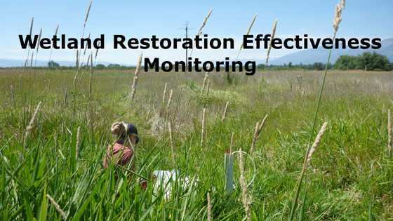
The goal of the wetland effectiveness monitoring project is to quantify the sediment and nutrient load reductions accomplished by wetland restoration. This includes quantifying effectiveness through time (i.e., short-term and long-term effectiveness) and through a variety of stream flow conditions (i.e., baseflow and stormflow or spring runoff) and associated wetland hydroperiods.
Objectives inherently associated with this goal are to:
- Compare quantified load reductions to the more typically reported modeled load reduction estimates, if methods for load reduction estimates exist
- Track effectiveness by Cowardin wetland types
- Improve maintenance and designs of future wetland restoration projects
- Inform potential future nutrient trading programs
- Provide more accurate load reduction information for future Total Maximum Daily Load development
This project is not intended to influence wetland mitigation crediting, which is an established process primarily under the jurisdiction of the U.S. Army Corps of Engineers.
2022 Sampling and Analysis Plan